Forests and nature reserves -- which can include beaches and wetlands, prairies and meadows, and even desert landscapes -- have long been recognized as places for social interaction, psychological renewal, recreation, and education. In recent decades, scientists have also learned more about how natural areas provide ecosystem services such as carbon sequestration, air and water purification, and large-scale nutrient cycling for entire regions. Preserving and restoring natural areas is a remedy for long-term regional, urban, and suburban challenges, such as climate change, pollution, and loss of productive agricultural lands. Governments,
organizations, and communities must continue to invest in forests and nature reserves, protecting nature in the process.
A number of states and local governments have taken steps to raise
much-needed revenue to create, expand, and preserve these important systems. Revenue bonds, transfer of development rights, and partnerships
with the private sector or non-profit organizations are just a few of
the methods used to create resources for natural conservation areas.
Policy makers should also consider increased multiple-use trails, rails-to-trails, both "wild and
scenic" and recreational river and greenways programs, which all provide educational opportunities that enable people to learn about the value of forests and reserves.
As urbanization continues, it's critical for communities to work regionally to coordinate planning and design for maintaining forests and reserves. Green infrastructure of special natural, scenic, and cultural
significance should be protected and preserved. In rural areas, existing
parks should be rehabilitated to protect vanishing landscapes.
Forest and nature reserve benefits include:
Water Management
Watersheds with more forest cover have been shown to have higher groundwater recharge, lower stormwater runoff, and lower levels of nutrients and sediment in streams than areas dominated by urban and agricultural uses. A U.S. Geological survey study of nutrients in undeveloped watersheds (mostly forested) found that forests ¡°produced the best water quality in the country.¡±
- Forests delay water through greater interception in their multi-layered leaf canopy.
- Forests have sturdy, long-lived roots that help to anchor soil against erosion. Deep roots also promote greater evapotranspiration (drawing water from soil and releasing it as water vapor into the atmosphere) and thus create soil water deficits, allowing forest soils to absorb more water during storm events (think dry sponge versus wet, saturated sponge).
- The forest litter layer further promotes infiltration of water into the soil, slows water flow above-ground, and decreases erosion.
- Sub-surface water flow minimizes pollutant and sediment contamination of waterways, and gives ample opportunity for plants and microbes to take up nutrients.
- A large-scale watershed study analyzing 16 river mixed-use basins in the Northeast found that nitrogen loading downstream decreased as percentage of forest land increased.
- Forest canopy in the Pacific Northwest was also found to minimize the
impact of rain-on-snow storm events, as evergreen conifers intercepted
rain precipitation. Reduced windspeeds and more consistent air
temperatures due to forest canopy also resulted in slower snowmelt and
more gradual run-off rates. (1)
Economic
- Sanitation District #1 in northern Kentucky (covering 220 square miles)
developed an integrated watershed-based plan providing cost savings of up to
$800 million. Its green infrastructure projects will reduce annual combined
sewer overflow (CSO) burden by 12.2 million gallons. (2)
- Seven U.S. cities with excellent water quality (resulting from
protecting regional forest systems) have saved from $500,000 to $6 billion in
avoided water treatment infrastructure costs (2)
Air Pollution
- According to a study quantifying ecosystem services resulting from Portland, Oregon¡¯s green
infrastructure practices in 2009, public acquisition of natural areas reduced particulate matter less than 10 micrometers in diameter (PM-10) by 23.3 lbs per acre per year. (3)
Property Value
- One study found home values within 800-1,000 feet of parks
increased in property value by 14 percent. Property values increased by 3-13 percent near forests with restored streams. (3)
Sources:
(1). World Resources
Institute
(2).¡°Banking on Green: A Look at How Green Infrastructure Can Save Municipalities Money and Provide Economic Benefits Community-wide,¡± Ë¿¹ÏÊÓƵ
(3). Environmental Services, City of Portland
Organizations
Government Resources
, NYC Department of Parks and Recreation
Research
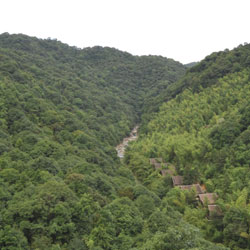
 Ë¿¹ÏÊÓƵ 2010 Honor Award. Crosswaters Ecolodge. Nankun Mountain Reserve, Guangdong Province, China. EDSA, Inc.
Nature of Cities
2013
"," U.S. Department of the Interior, Fish and Wildlife Service and National Oceanic and Atmospheric Administration, National Marine Fisheries Service, 2013
Forestry Commission of Edinburgh, 2012
Green Infrastructure Center 2012
¡°,¡± Appleseed / Central Park Conservancy
"," Project for Public Spaces
"," Project for Public Spaces
¡°,¡± American Planning Association
"," Trust for Public Land, 2008
Role of the Landscape Architect
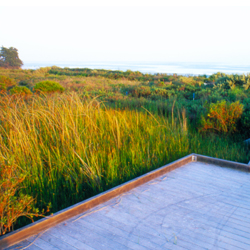
 Ë¿¹ÏÊÓƵ 2008 Professional General Design Honor Award, Lagoon Park: Living at the Edge of Wilderness, Santa Barbara, California, Van Atta Associates, Inc. / Image Credit: Saxon Holt
Since Frederick Law Olmsted, who founded the profession of landscape architecture, landscape architects have created regional plans, which lay out areas for development and other areas for the protection and preservation of natural areas. These plans enable growth to happen elsewhere, making forest and nature reserve protection real for the long-term.
At the planning level, landscape architects work with communities and scientists to analyze existing green spaces and determine the most important areas for conservation and recreation and propose areas for reforestation and a restoration.
Landscape architects create master plans for parks, trail networks, wildlife habitats, recreation and gathering spaces; and draft design details from road systems on down to visitor centers, transportation systems, and interpretive art and signage.
Projects
The Restoration of Giant Forest, Sequoia National Park, California (National Park Service)
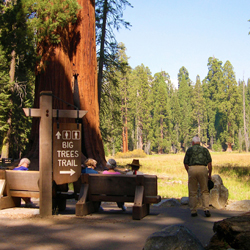
 Ë¿¹ÏÊÓƵ 2007 Professional General Design Award, The Restoration of Giant Forest, Sequoia National Park, California, National Park Service / Image credit: National Park Service
Core Area of Lotus Lake National Wetland Park Landscape Planning, Tieling City, Liaoning Province, China (Beijing Tsinghua Urban Planning & Design Institute, Beijing, China)
, Land Trust for Tennessee
, NYC Environmental Protection
Green Plan Philadelphia, Philadelphia (Wallace Roberts & Todd)
, Los Angeles (Conservation Fund)
An Emerging Natural Paradise ¡ª Aogu Wetland Forest Park Master Plan, Taiwan (National Sun Yat-sen University)
Lagoon Park: Living at the Edge of Wilderness, Santa Barbara, California (Van Atta Associates, Inc.)
South Africa.
Orange County Great Park Comprehensive Master Plan "A Vision for the Great Park of the 21st Century", Irvine, California (Ken Smith Workshop West and Mia Lehrer + Associates)
"Red Ribbon" Tang He River Park, Qinhuangdao City, Hebei, China (Kongjian Yu / Turenscape)
<< Overview
Wildlife Habitat & Corridors >>